 Home
Home
The Story of
Vanport, Oregon
MyHistoryStone Archive
1942 – 1948
Portland, Oregon, United States · 6 years
Location
North Portland
Circa
1942
In motion
4 photographs
The photographs on this page, brought to life.
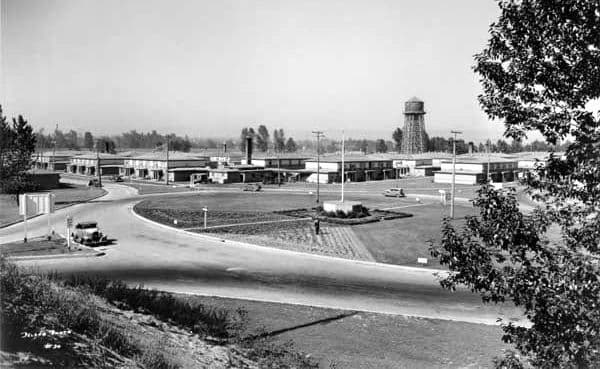
Vanport in 1943: the shopping centre and the water tower, in a city built in about a year. City of Portland (OR) Archives, via Wikimedia Commons.
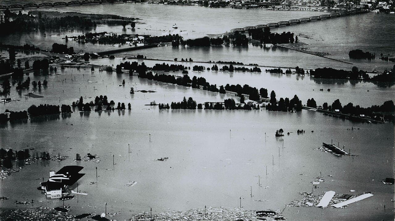
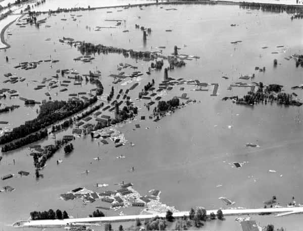
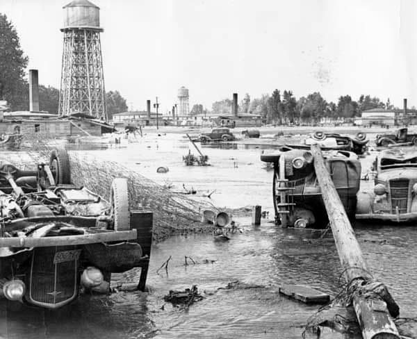
Oregon's second-largest city lasted five and a half years and is now a golf course. Vanport was built in 1942 to house the people who built ships. Henry Kaiser needed workers for three shipyards on the Columbia, the workers needed somewhere to live, and Portland had nowhere to put them. The U.S. Maritime Commission approved the plan on 18 August 1942 and the first tenants moved in on 12 December. Ten months, start to finish, on 650 acres of river floodplain. Nearly ten thousand apartments. A library, a post office, a police station, an infirmary, a 750-seat cinema, and a 24-hour nursery that cooked hot meals for parents coming off shift, described at the time as the largest childcare programme in the world. At its peak in December 1944 about 42,000 people lived there. Oregon had spent most of its history trying to keep Black people out. An exclusion clause was written into the state's own Bill of Rights in 1857 and was not repealed by voters until 1926, and there were fewer than 1,800 Black residents in the entire state in 1940. By 1946 more than 15,000 lived in the Portland area, most of them in Vanport. The apartments were assigned by race. The schools were not: classes and faculty were integrated, and they ran seven days a week. On Memorial Day, 30 May 1948, at 4:17 in the afternoon, a railway embankment on the western edge gave way. Water fifteen feet above the floodplain came through a gap in what everyone had been told was a dike. Sloughs inside the city absorbed the first surge, which is the only reason the number below is as low as it is. People had somewhere between thirty-five and forty minutes. Vanport was gone in under two hours, and nobody has lived there since. Fifteen people died, and that number has been argued over ever since. The Oregon Encyclopedia says fifteen. The official state marker erected in 2009 says eighteen. A 1949 Geological Survey report says at least sixteen. In the Black community a conviction took hold that the true toll was far higher and had been concealed, and that the warning had been withheld deliberately, a belief persistent enough that a historian devoted an article in the Oregon Historical Quarterly to it fifty years later. The state's own encyclopedia calls those rumours unfounded. We could find no source substantiating a higher figure. We could find no source that explains the gap between fifteen and eighteen either. What is documented is what residents were told that morning. The Housing Authority of Portland issued a statement, and the wording survives: "Remember: Dikes are safe at present. You will be warned if necessary. You will have time to leave. Don't get excited." Eighteen thousand five hundred people were living there when it went out. No source we could reach says how it was distributed, whether handed out, slipped under doors or posted on boards. The dike broke that afternoon. The people who lost their homes went into a Portland that mostly did not want them. More than a thousand of the flooded families were Black and could find housing only in Albina; by 1960 nearly four in five Black Portlanders lived there. One institution survived intact. The Vanport Extension Center refused to close, reopened downtown, and is now Portland State University. The site is West Delta Park, Portland International Raceway and a golf course. There is a marker by the dog park car park. If your family was in Vanport, or came out of it, that is the part of this story nobody wrote down. Add it here. Compiled by MyHistoryStone from the Oregon Encyclopedia, the Oregon Historical Society, Oregon Public Broadcasting, Portland State University and the Oregon state historical marker.
Add to this story
Know something about Vanport, Oregon? Add it here - a memory, a detail, a correction. What you write appears right away, and the page owner can remove any entry.
Loading messages...